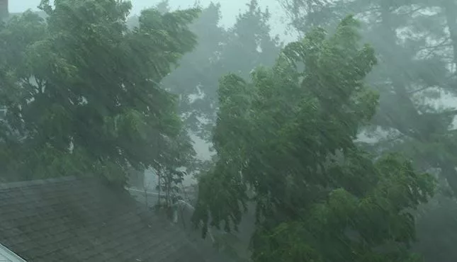
PORT ANGELES — A powerful storm expected to hit the area Tuesday evening through early Wednesday could bring damaging winds, heavy rain, and minor flooding, according to the National Weather Service in Seattle.
The region’s coastal areas and the Strait of Juan de Fuca will also face strong east to southeast winds, with gusts peaking between 5 p.m. Tuesday and 3 a.m. Wednesday at over 55 miles per hour. High winds may down trees and power lines, resulting in power outages and hazardous travel conditions.
Rainfall in the west and southeastern Olympics is forecast to cause sharp rises in river levels. Additionally, the storm could exacerbate already high tide levels, potentially causing minor coastal flooding and shoreline erosion along the Strait and other low-lying areas.
The mountains will also get plenty of snow. Travelers crossing the Cascade passes should prepare for snow-covered roads and possible blizzard-like conditions. Snow levels are expected to drop to 1,000–2,000 feet, with heavy accumulation likely overnight Tuesday into Wednesday.
Residents are urged to secure outdoor structures, monitor flood alerts, and prepare for potential power disruptions as the storm progresses. Another, albeit weaker, system is expected to follow later in the week.