PORT ANGELES – Winter weather is blowing into our area today.
A wind warning is up for today on the north Olympic Peninsula, as strong westerly winds are expected to gust to over 50 miles an hour.
That’s being accompanied by a lot of rain. The heavy rain coupled with high tides have a coastal flooding watch up for the Peninsula as well.
Then the cold comes. By Thursday, forecasters expect temperatures to dip to well below average for this time of year. And by this weekend highs may not get out of the 20’s.
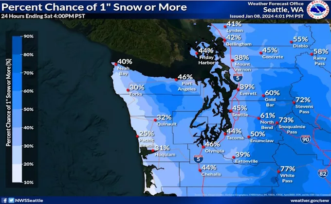
With that also comes a threat of snow Thursday through Saturday. National Weather Service meteorologist Kirby Cook in Seattle says our area could see potentially more snow due to a “strait effect”.
“You know whenever we get cold air like this, we have to have Fraser outflow. And when that happens the normally relatively dry part of the Olympic Peninsula from Port Angeles over to Port Townsend becomes upslope and that’s where you guys get more snow than anybody else and that’s tin the realm of possibility with this,” Cook said on Newsradio KONP’s Todd Ortloff Show.
There’s 40-60% two inches or more of snow hitting the area Thursday night and again on Saturday. Cook says the forecast models continue to evolve heading into the weekend, so a lot of this is still in flux. However, he’s confident that very cold temperatures will be coming. That means potentially tough travel due to icy roads plus issues that come for those without shelter and animals outside.