

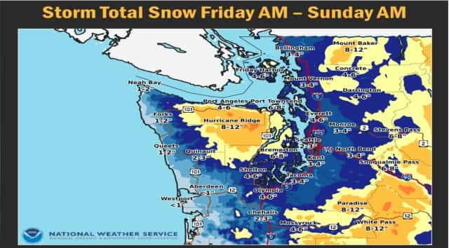
PORT ANGELES – Get ready for a significant snow storm coming to the north Olympic Peninsula.
Forecasters have a winter storm watch up for the area starting tonight and lasting at least through Saturday.
Snow, heavy at times, is expected to fall beginning Friday evening. That snow is forecast to continue through the night Friday and early morning Saturday.
The National Weather Services now expects six inches in the low land areas along the Strait of Juan de Fuca. Hills above 200 feet could get a foot or more. Breezy conditions are also expected to pick up Friday night and could cause drifting snow and poor visibility. Already cold roads are expected to ice up even more creating hazardous travel conditions.
Temperatures are expected to be very cold, with highs in the low 30’s and lows at night continuing in the low 20’s.
And that’s not the end of it. We’re watching another similar storm that could roll into the area next week.